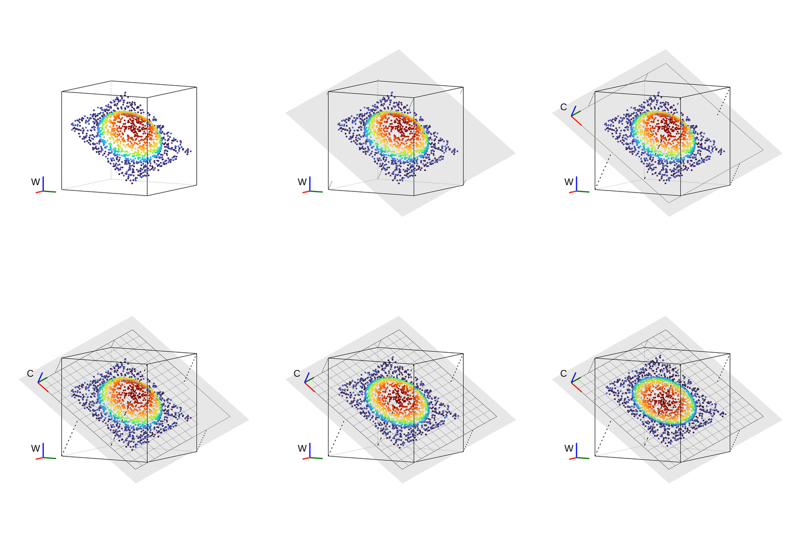
Inside each voxel (0.5m), we iteratively calculate a dominant plane using point covariance. Based on the footprint of the voxel's corner on this plane, we define a local image coordinate system with pixels of 5cm. Each incoming LiDAR point is then projected onto its voxel's oriented image plane.
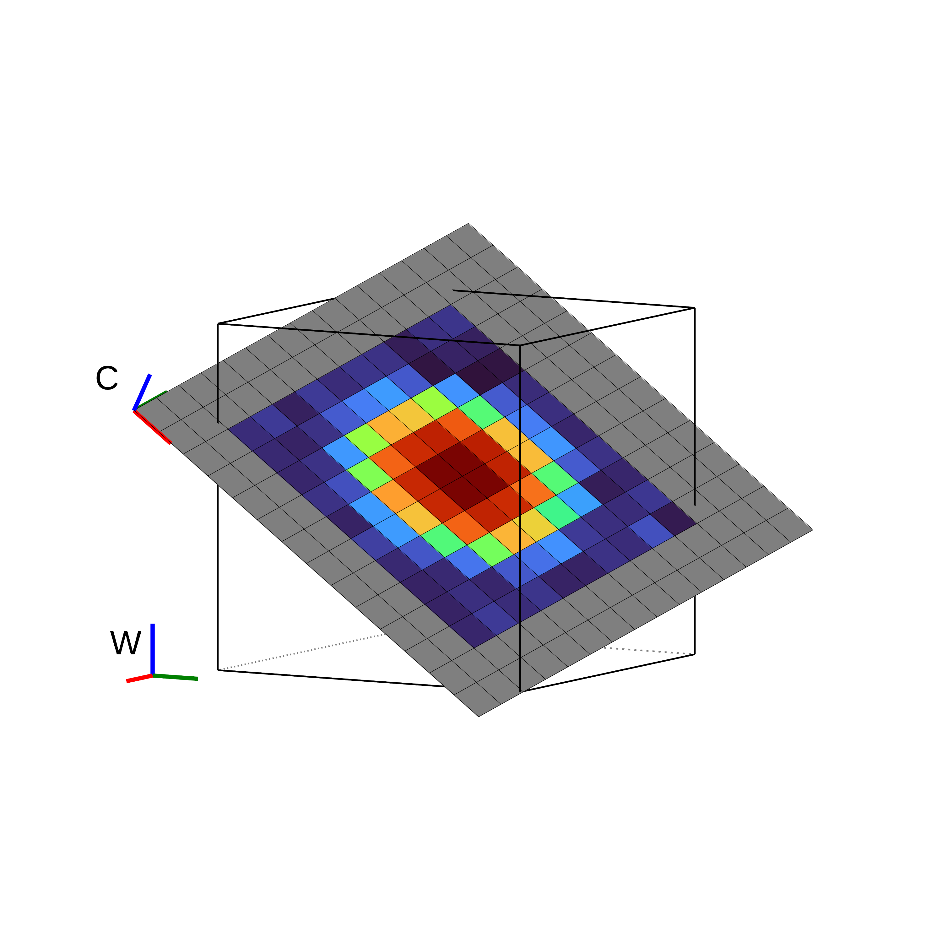
The points' height above the plane is stored in the corresponding pixels using a distance-weighted averaging scheme, accumulating a high-resolution height image of the local surface across multiple scans.
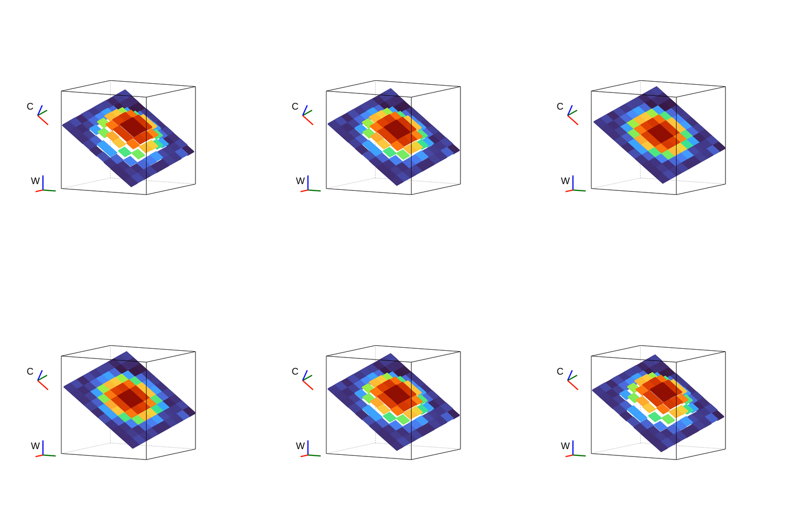
By only storing the deviation from the dominant plane per pixel, BIEVR encodes rich 3D geometry in a compact 2D image at high resolution without assuming a specific geometric primitive, which enables the representation of subtle details.
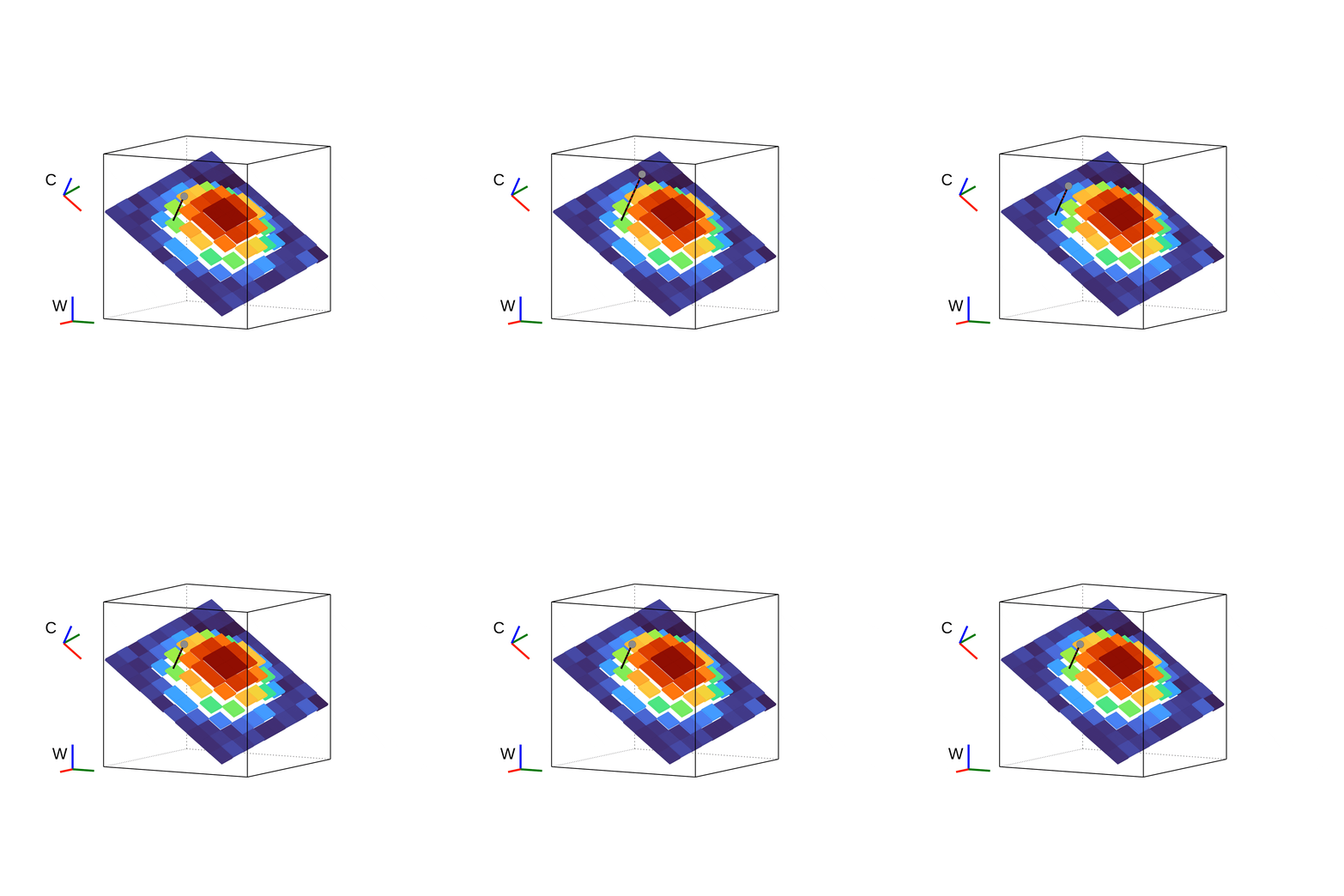
The BIEVR representation can directly be used for scan-to-map registration. We minimize the difference between each input point's height above the image plane and the stored pixel value. The resulting Jacobians combine a normal-direction term (similar to point-to-plane ICP) with two additional gradient directions from the height image, recovering constraints in directions that are unobservable under classical point-to-plane alignment.
To effectively exploit the geometric cues encoded in BIEVR during registration, sampling must be dense enough to capture the local surface variations. However, uniform high-resolution sampling is computationally expensive and often unnecessary, as many regions of the environment are flat and uninformative. We thus score each voxel by its Mean Image Distance (MID) and use a dual-resolution strategy: dense sampling (0.1 m) in the highest-scoring voxels, coarse sampling (0.5 m) elsewhere.
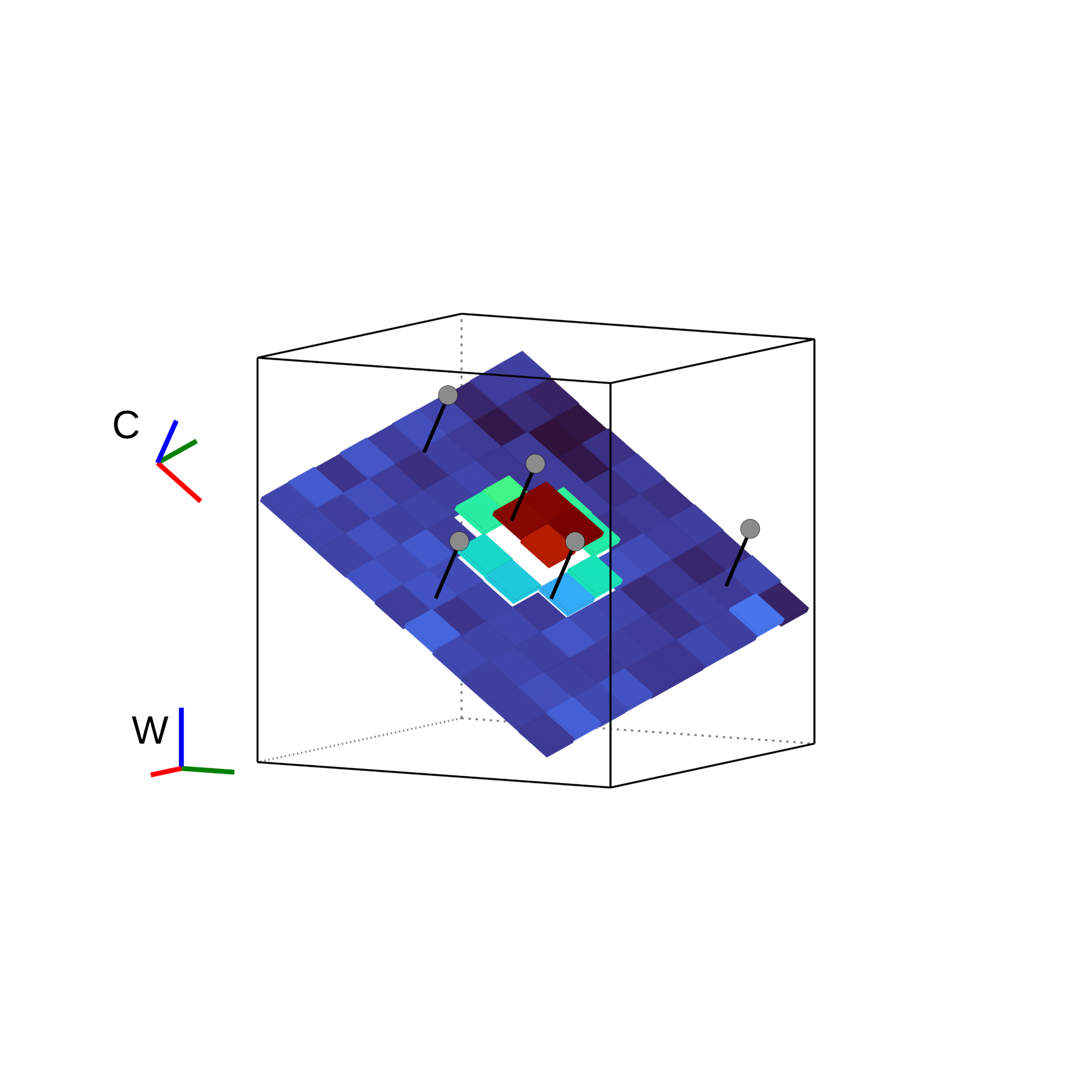
A voxel with high MID contains rich geometric detail that generates informative registration Jacobians beyond the planar component. Multiple points are retained at a higher resolution to fully exploit these cues.
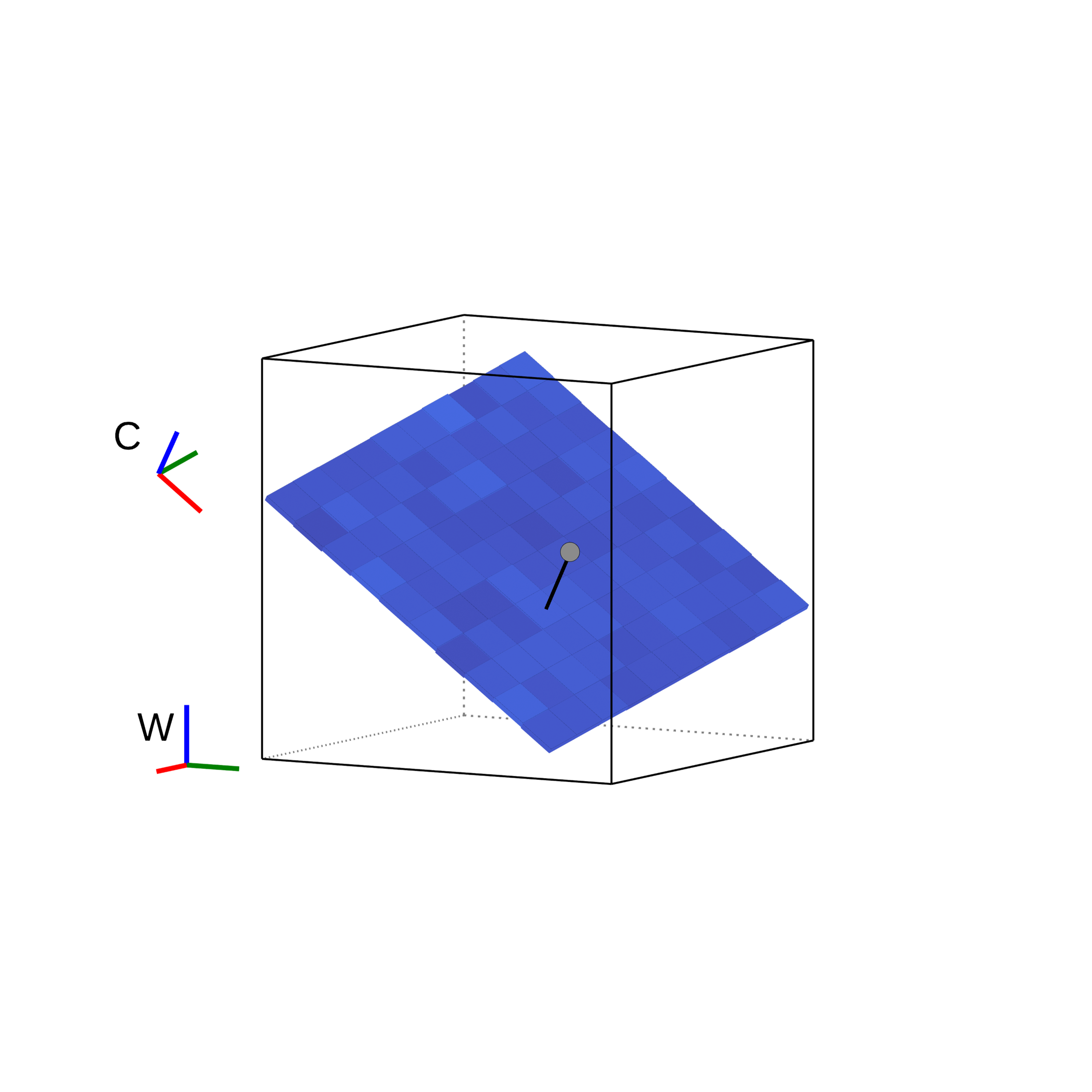
Flat voxels with low MID only provide a planar constraint. Thus, only a single point is kept, reducing computational cost without discarding meaningful information.
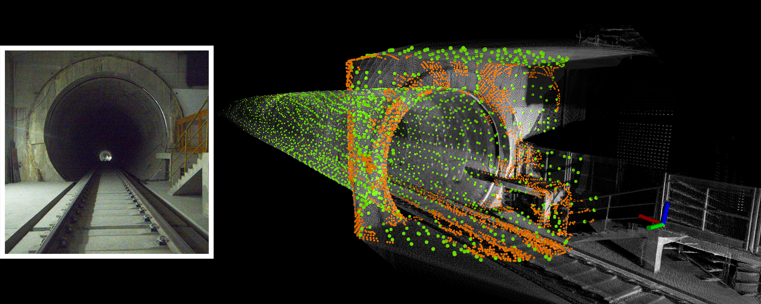
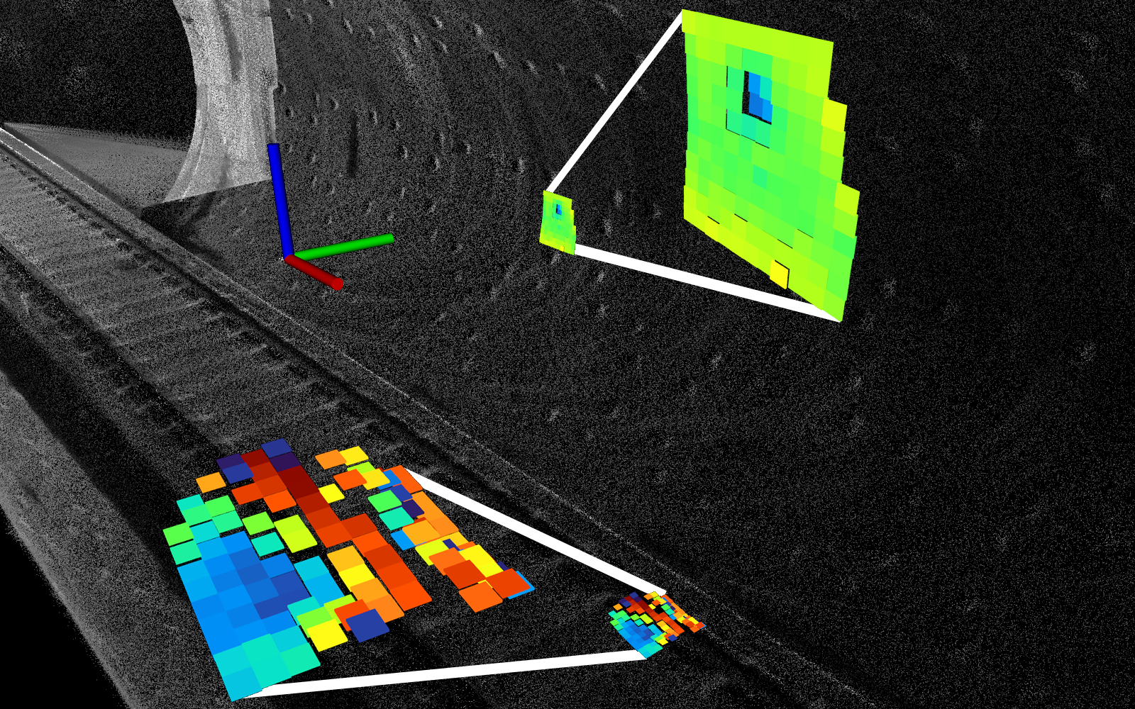
Map-informed sampling in the Shield1 metro-tunnel sequence. Dense points (orange) concentrate on geometrically salient regions such as the track bed, edges and corners, while sparse points (green) cover less detailed surfaces like the ceiling and floor. Compared to uniform high-resolution sampling, this strategy reduces the number of registration points while improving accuracy by focusing computation on relevant areas.
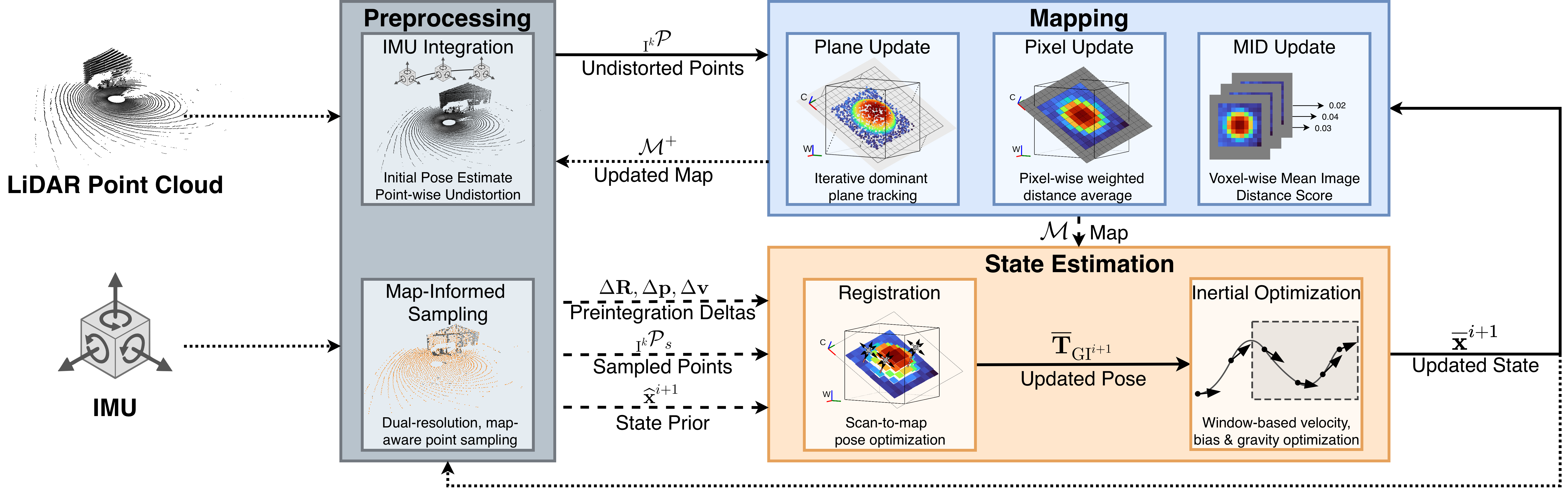
BIEVR-LIO follows a loosely-coupled LiDAR–inertial fusion. IMU measurements are used solely for point-wise scan undistortion and to provide an initial pose estimate via preintegration. Pose estimation is performed exclusively through scan-to-map registration against the BIEVR map, which decouples it from inertial parameters and thereby removes the need for IMU-specific noise tuning. This makes the system operate robustly across diverse LiDAR and IMU configurations using the same set of parameters, as demonstrated in our experiments.
After pose estimation, a separate sliding-window inertial optimization estimates velocity, gravity direction, and IMU biases using a fixed 10 s window in which gravity and biases are treated as window-constant variables.
BIEVR-LIO achieves robust odometry across a wide range of challengingenvironments, including metro tunnels, open runways, grass fields, and indoor spaces, where competing geometry-based approaches diverge or fail entirely. The system runs in real time on CPU using the same parameter set across all platforms and sensors, with no per-environment tuning. Full numerical benchmarks across five public datasets are available in our paper.
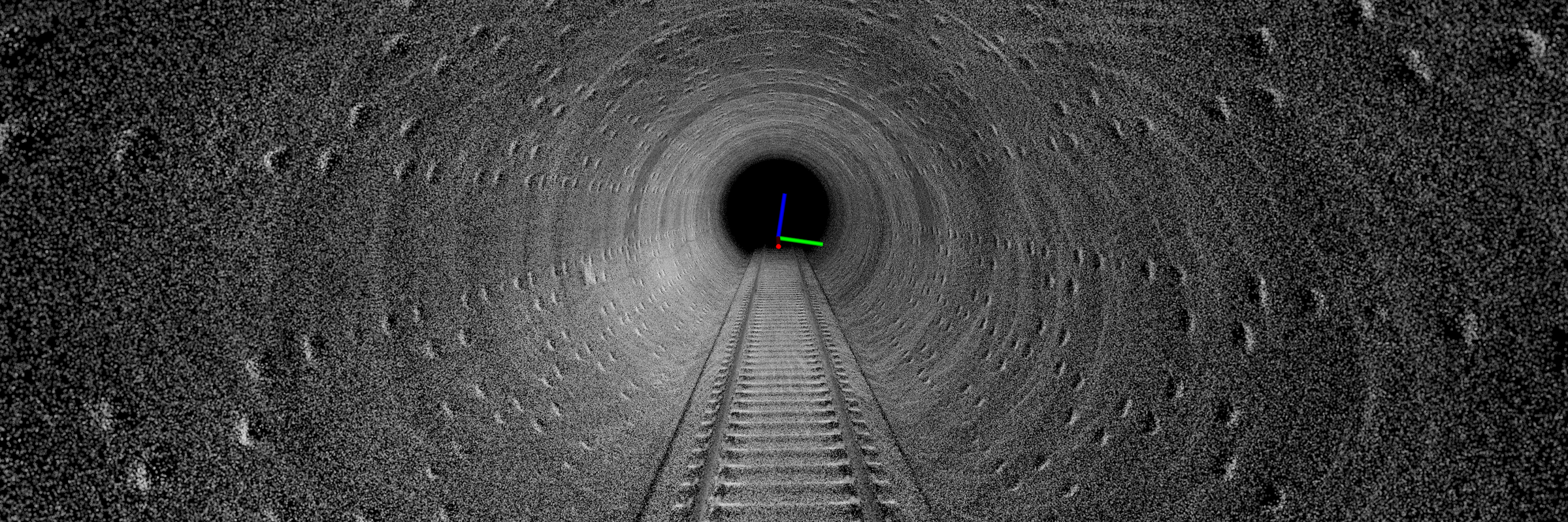
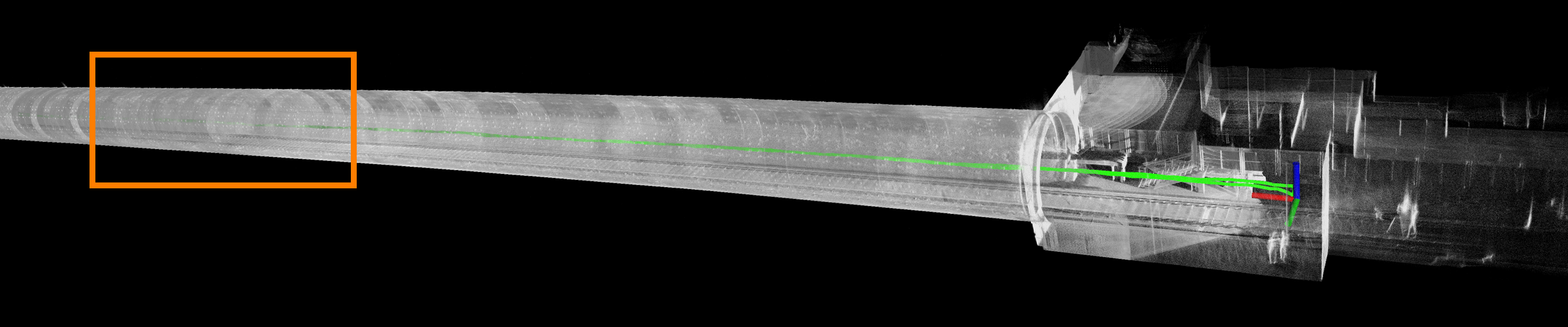
Accumulated map from the Shield1 metro-tunnel sequence. The high-resolution BIEVR representation resembles the train bed relief and wall cutouts, that fully constrain the longitudinal tunnel axis and that most methods cannot exploit due to low resolution.
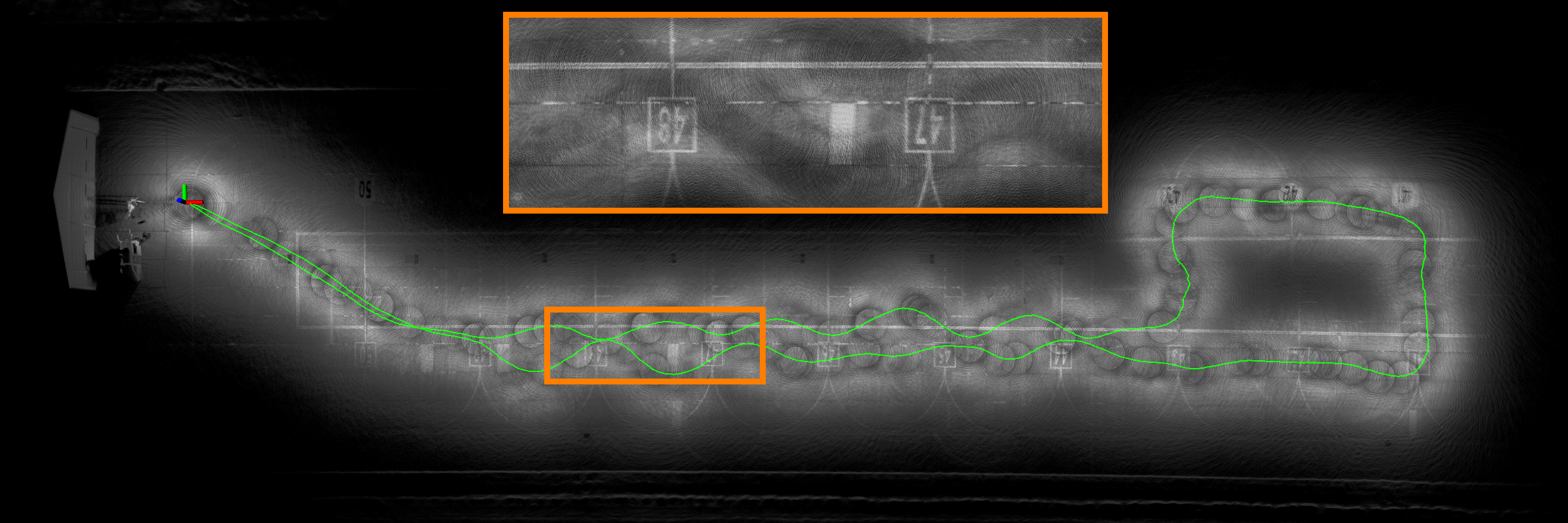
After a full loop around a runway, ground markings remain crisp and well-aligned in the accumulated map, which demonstrates accurate odometry in a flat environment.
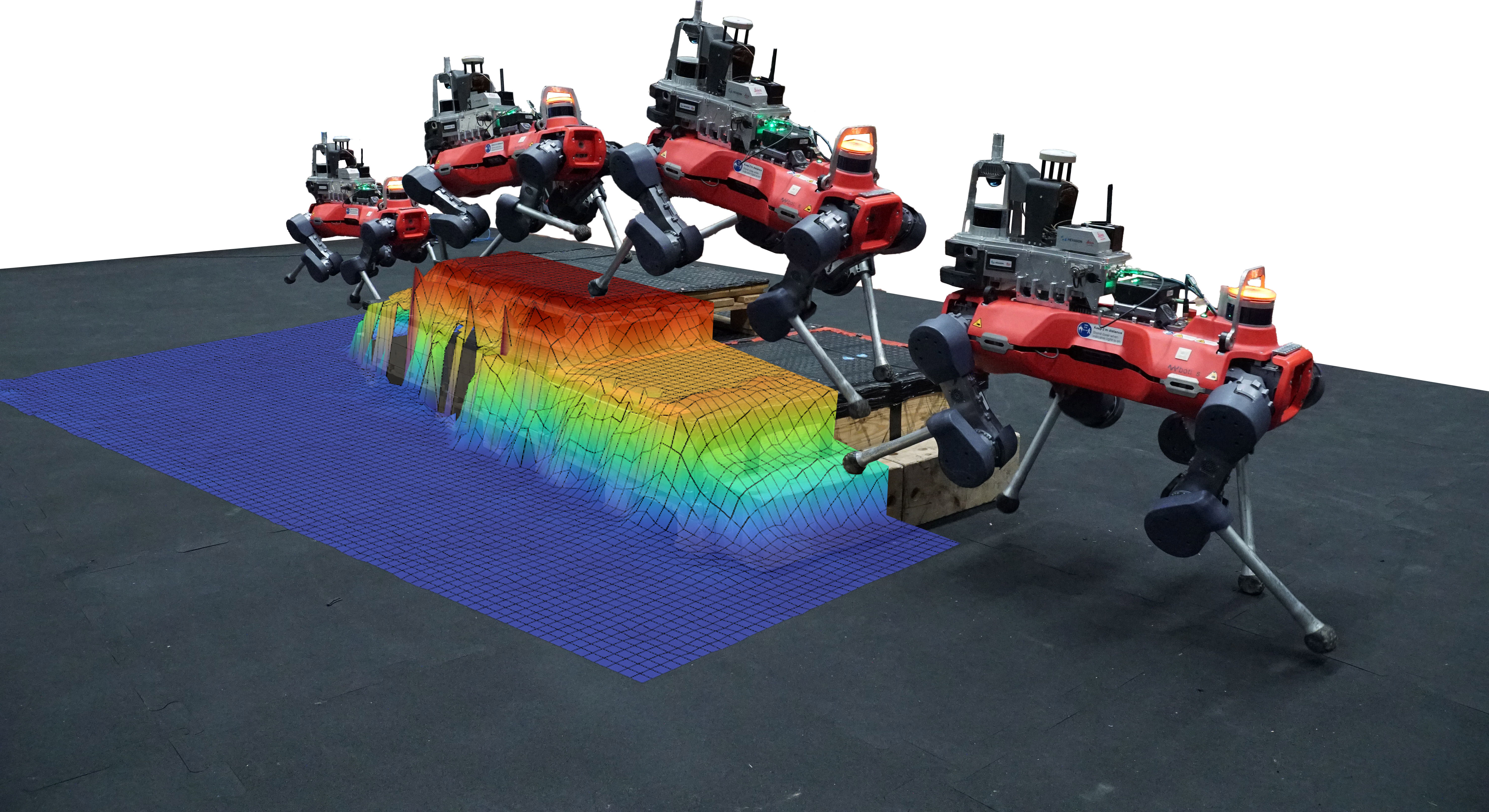
BIEVR-LIO is efficient enough to run in real time on onboard robot hardware, and its map can be used directly in downstream applications. Here, a quadruped robot uses the BIEVR map as an elevation map for footstep planning, successfully traversing an obstacle of stacked pallets.
@article{pfreundschuh2026bievr,
	title        = {BIEVR-LIO: Robust LiDAR-Inertial Odometry through Bump-Image-Enhanced Voxel Maps},
	author       = {Pfreundschuh, Patrick and Tuna, Turcan and {Le Gentil}, Cedric and Siegwart, Roland and Cadena, Cesar and Oleynikova, Helen},
	year         = 2026,
	journal      = {Robotics: Science and Systems},
    }